In a field once untouched, a goose flaps its wings—and a map lights up.
Cameras blink. Coordinates ping. A name is assigned.
Each leaf, each flight path, each bark fracture becomes a data point. Nature is no longer observed—it is parsed, labeled, nested in parenthesis.
What you’re looking at isn’t a forest. It’s a database dressed as one.
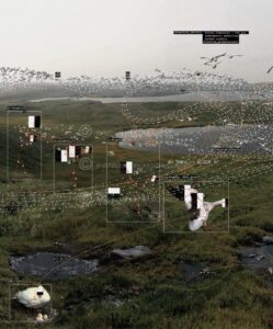
The first image captures a swarm of birds mid-migration, intercepted mid-code. Atmospheric predictions, carbon credit projections, and future time scales overlay the sky like invisible fences. They call it modelling, but it feels like surveillance. The birds may still move freely, but their movements now belong to a ledger.
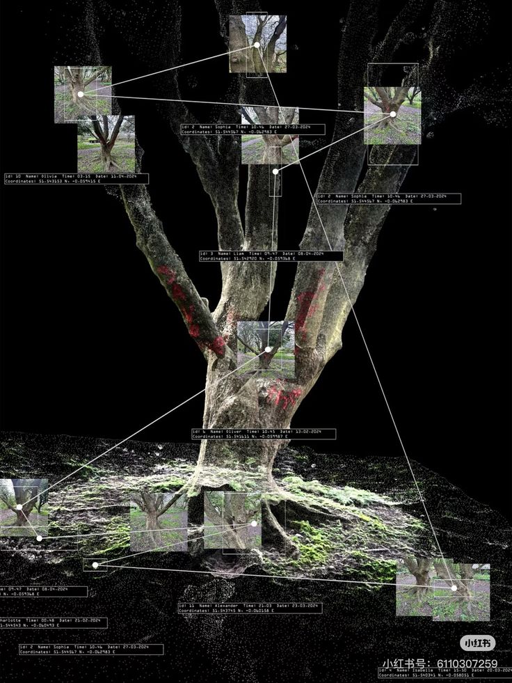
The second image goes deeper. A tree dissected, node by node. Each branch becomes a hypothesis. Each image frame a fossil of a moment. It’s a genealogy of presence: who touched what, where, and when. The bark bleeds red—perhaps naturally, perhaps not.
This is more than environmental monitoring. It’s ecological quantification as philosophy. The tree is no longer just a being—it is a user interface.
What if we are no longer walking through landscapes but through neural networks trained on roots and wings?
We once climbed trees to feel something. Now we scan them to optimize growth curves and compare soil memory across bioregions.
And yet, despite the coordinates and precision, something escapes. A branch not yet scanned. A wing beating just beyond the lidar’s reach.